On the 1st of February we began the first prescribed fire intervention in the Lamas de Ôlo and Dornelas common land. We were pleased to be able to count on the support of UTAD’s Rural Fire Management postgraduate group and the honour of the company of LIFE Maronesa breeder Heitor Fernandes.

The intervention area identified for this common land corresponds to an approximate area of around one hundred hectares, all of it clustered with very few breaks in continuity and transition zones where the density of shrubs is considerably reduced in order to make the intervention quicker.
This patch is mainly made up of dense brooms between one and two and a half metres high, interspersed with smaller (one metre high) carqueja and heather, but equally dense and difficult for the cattle and other wild animals to access. This type of shrub composition, its advance and expansion into marginal mountain areas, is one of the serious problems identified by our project. It was one of the main vectors for the spread of the fire in September 2024 in the Souto and Outeiro common land.
The reason for this is that after it reaches a certain height in its growth, it is no longer of interest to cattle and other wild animals (apart from a few more accessible fresh shoots) and the cost of utilising it for animal beds or shredding it using machinery, with the stoniness of the mountains, is around unaffordable prices for the resident farmers. In addition to the overshadowing that prevents other species of greater interest to the ecosystem from germinating, growing and competing for access to sunlight, the release of carbon into the atmosphere and the burning of organic matter in the soil when consumed by summer wildfires, these areas are a danger to the residents of the two villages, their property and their livelihoods. In order to maintain the few people who live here (and be able to welcome more) and manage the territory’s ecosystem, it is imperative and urgent that action is taken in these areas.

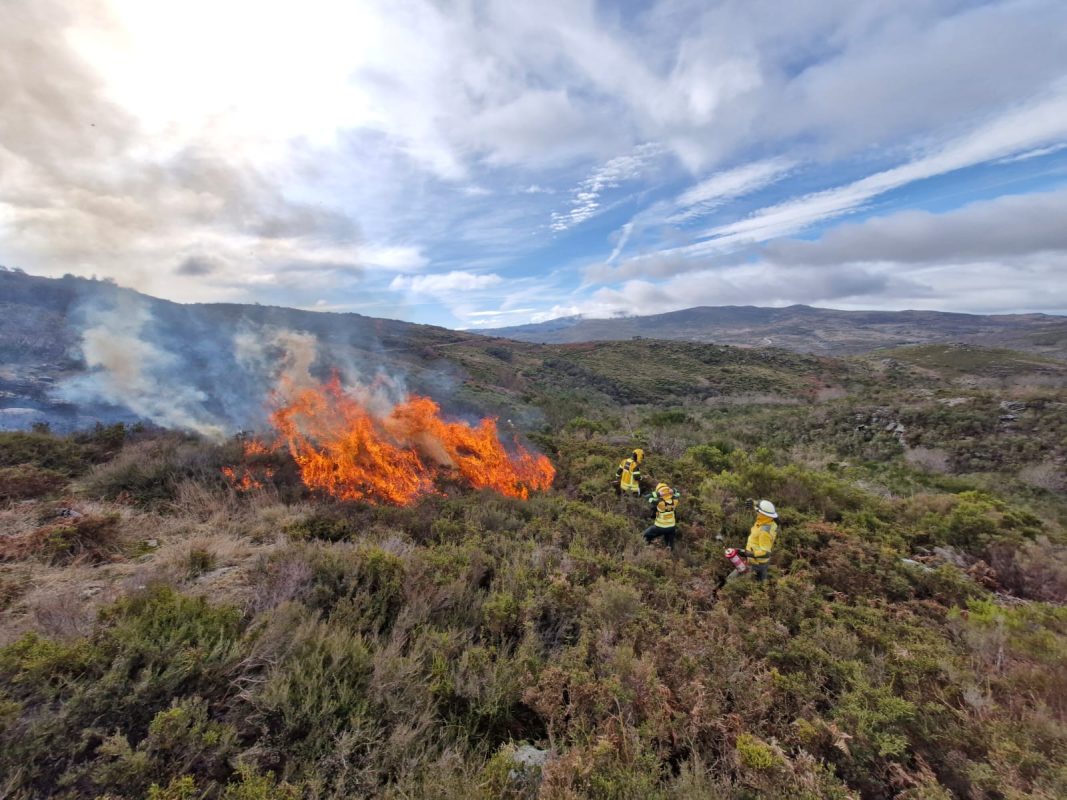
The operational plan to convert these areas into pastures near the two villages involves several days of work due to the complexity of the land morphology and the continuity of the available vegetation. On day 1, the first intervention essentially involved identifying and creating anchoring zones in this area to prepare future actions.
These first interventions usually tend to take longer, some patience is required because the ignition point technique is used and more time is spent selecting the points, observing and monitoring the progression of the flame than actually using more fuel from the drip torch.
With only two days of sunshine after the recent rains, we started the day with little hope of success in terms of the availability of the fuel to burn. We opted to start working in a higher elevation area, with greater exposure to the wind and to the south, in order to guarantee a greater chance of finding drier material available for consumption than elsewhere in the area to be managed. The operation went very successfully, to everyone’s surprise, but the entry of humidity and some clouds in the early afternoon resulted in the initiative being interrupted earlier than planned.